Old Ottawa South
A compact neighbourhood between the Rideau Canal and the Rideau River, in Capital Ward.
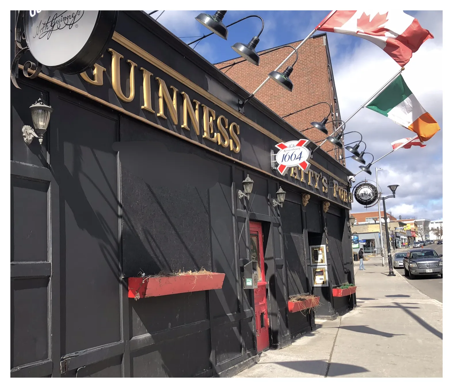
Old Ottawa South is an older urban neighbourhood in Capital Ward, with 6,480 residents and 2,650 private dwellings in the 2021 census (via the Ottawa Neighbourhood Study). Population: 6,480 (2021).
Updated · Facts on this page link to their sources
About Old Ottawa South
Old Ottawa South is an older urban neighbourhood in Capital Ward, with 6,480 residents and 2,650 private dwellings in the 2021 census (via the Ottawa Neighbourhood Study). Its housing is mostly low-rise: 51.1% single-detached, with owner households making up 72.5% of the total. It developed as a streetcar suburb in the early 1900s, and Bank Street remains its local commercial corridor. The median age was 41.6 in 2021.
Boundaries
Ottawa Neighbourhood Study area 'Old Ottawa South'; Wikipedia describes it as lying between the Rideau Canal and the Rideau River, from Bronson Avenue to Avenue Road. ons-sqo.ca ons-sqo.ca
Homes
In the 2021 census (via the Ottawa Neighbourhood Study), 51.1% of dwellings in Old Ottawa South were single-detached houses, 12.7% semi-detached, 11.1% row houses and 17.4% apartments in buildings under five storeys; 7.3% were flats in a duplex and none were in buildings of five or more storeys. Owner households made up 72.5% and renter households 27.3%. The median owner-estimated value of owned dwellings was $900,000. ons-sqo.ca
- 6,480 residents and 2,650 private dwellings (2021 census, via the Ottawa Neighbourhood Study)
- Ward 17 (Capital), per City of Ottawa ward data, October 2026
- Carleton O-Train station about 1.2 km away (straight-line)
- Hopewell Avenue Public School about 0.2 km away (straight-line)
- Tree canopy coverage of 30.2% in 2024
- Bike Score of 96 and Walk Score of 42 (ONS neighbourhood averages)
Community
How Old Ottawa South came to be
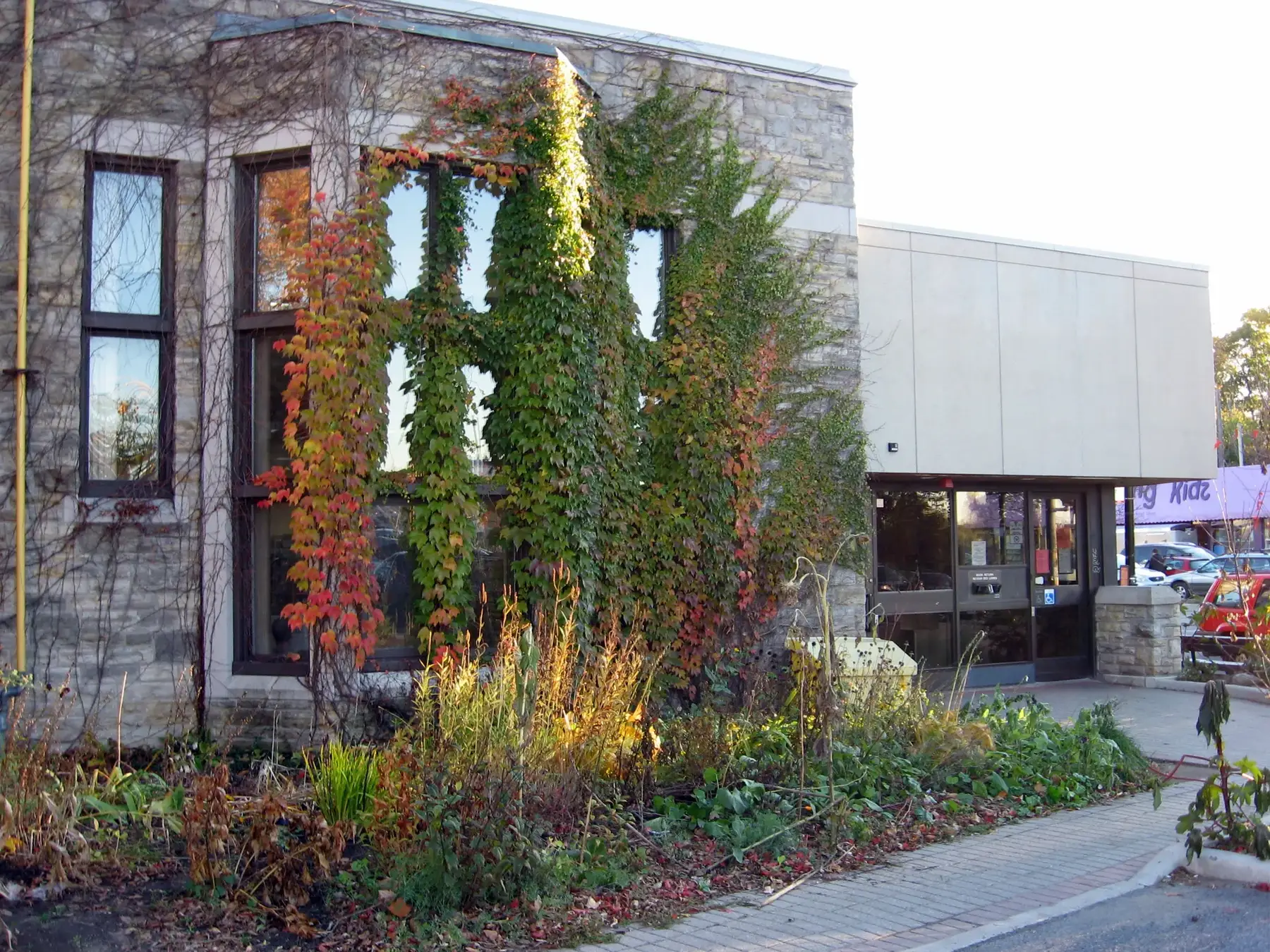
- 1814
The area was originally settled around 1814 by American and British settlers. en.wikipedia.org
- 1867
Shortly after Confederation, a bridge was built over the canal, improving access from the city to the north. The area was tentatively called Rideauville. en.wikipedia.org
- 1905
Rideauville was incorporated as a police village. en.wikipedia.org
- 1907
Rideauville was annexed to the City of Ottawa. en.wikipedia.org
- 1910
The streetcar tracks were extended to the area, encouraging rapid growth. Hopewell School was built around this time. en.wikipedia.org
- 1920
Brighton Beach opened as a public swimming venue on the Rideau River; it was officially closed in 1970 under new City pollution standards. en.wikipedia.org
- 1932
The Mayfair Theatre opened. It was later designated under the Ontario Heritage Act, in 2008. en.wikipedia.org
The 'Old' in Old Ottawa South came into use in the 1990s to distinguish the community from newer suburban developments in the south of Ottawa. en.wikipedia.org
- 2007
Residents founded the Ottawa South History Project ahead of the 100th anniversary of annexation. en.wikipedia.org
Local names worth knowing
- Jim Watson
Former mayor of Ottawa, who lived in Old Ottawa South for nearly two decades before moving away in 2004. en.wikipedia.org
- Paul Hellyer
Canadian politician who served as Minister of National Defence and Minister of Transport; he lived near Brighton Beach in the neighbourhood. en.wikipedia.org
- Samuel T. Bastedo
Canadian public servant who lived at 692 Echo Drive from 1913 until his death in 1927. en.wikipedia.org
Around Old Ottawa South
Walking rings at 5, 10 and 15 minutes from the neighbourhood centre.
Schools
7 nearbyHopewell Avenue Public School
OCDSB17 av. Hopewell Avemaps.ottawa.ca ocdsb.ca
180 m2 min walkBlyth Academy The Glebe
Independent983 rue Bank Streetmaps.ottawa.ca
720 m9 min walkThe Element
Independent201-425 Marché Waymaps.ottawa.ca
990 m12 min walkMutchmor Public School
OCDSB185 av. Fifth Avemaps.ottawa.ca ocdsb.ca
1.1 km14 min walkCorpus Christi School
OCSB798 rue Lyon St Southmaps.ottawa.ca ocsb.ca
1.2 km15 min walkGlebe Montessori School
Independent650 rue Lyon Stmaps.ottawa.ca
1.4 km18 min walkGlebe Collegiate Institute
OCDSB212 av. Glebe Avemaps.ottawa.ca ocdsb.ca
1.5 km18 min walk
Straight-line distances from the Old Ottawa South centre. Living near a school does not guarantee a place: confirm the designated school for an address with each board. All schools and board locators.
Parks & places
10 nearbyBellwood Parkette
Passive Recreation park
100 Bellwood Avenue, Ottawamaps.ottawa.ca
320 m4 min walkOsborne Park
Passive Recreation park · waterfront access
21 Osborne Street, Ottawamaps.ottawa.ca
330 m4 min walkOttawa South Community Centre
Community Centre
260 Sunnyside Avemaps.ottawa.ca ottawa.ca
350 m4 min walkOttawa South Community Centre
Passive Recreation park
260 Sunnyside Avenue, Ottawamaps.ottawa.ca
350 m4 min walkOpen Space
Passive Recreation park · waterfront access
41 Warrington Drive, Ottawamaps.ottawa.ca
360 m5 min walkOttawa Public Library Sunnyside Branch
Public Library
1049 Bank Stmaps.ottawa.ca biblioottawalibrary.ca
390 m5 min walkLinda Thom Park
Passive Recreation park · waterfront access
1324 Bank Street, Ottawamaps.ottawa.ca
490 m6 min walkSplash pad, Brewer Park
Splash pad (summer only)
100 Brewer Way, Ottawamaps.ottawa.ca ottawa.ca
500 m6 min walkOutdoor rink, Brewer Park
Outdoor rink (winter, weather permitting)
100 Brewer Waymaps.ottawa.ca ottawa.ca
550 m7 min walkPercy Taverner Park
Passive Recreation park
130 Woodbine Placemaps.ottawa.ca
560 m7 min walk
Shops & dining
10 nearbyOpal Wellness Pharmacy
Pharmacy
1183 Bank Streetopenstreetmap.org
210 m3 min walkShoppers Drug Mart
Pharmacy
1080 Bank Streetopenstreetmap.org
260 m3 min walkCedars & Co. Food Market
Supermarket
1255 Bank Streetopenstreetmap.org
360 m4 min walkWhole Foods Market
Supermarket
951 Bank Streetopenstreetmap.org
830 m10 min walkPharmasave
Pharmacy
1355 Bank Streetopenstreetmap.org
840 m11 min walkWalmart Supercentre
Supermarket
2277 Riverside Driveopenstreetmap.org
840 m11 min walkWalmart Pharmacy
Pharmacy
2277 Riverside Driveopenstreetmap.org
880 m11 min walkBillings Bridge Shopping Centre
Shopping centre
2277 Riverside Driveopenstreetmap.org
900 m11 min walkBulk Barn
Supermarket
2269 Riverside Driveopenstreetmap.org
900 m11 min walkRexall
Pharmacy
2277 Riverside Driveopenstreetmap.org
910 m11 min walk
Getting around
TransitBillings Bridge station
Transitway / transit station (City of Ottawa transit stations layer)
openmaps.ottawa.ca
1.0 km13 min walkPleasant Park station
Transitway / transit station (City of Ottawa transit stations layer)
openmaps.ottawa.ca
1.1 km14 min walkCarleton station
O-Train Line 2
openwikidata.org en.wikipedia.org
1.2 km14 min walkRiverside station
Transitway / transit station (City of Ottawa transit stations layer)
openmaps.ottawa.ca
1.3 km16 min walkO-Train
Carleton station is about 1.2 km away in a straight line (open; Line 2).
O-Train
Mooney's Bay station is about 1.7 km away in a straight line (open; Line 2).
Transitway / bus
Billings Bridge station is about 1.0 km away in a straight line (open).
Downtown
Parliament Hill is about 3.7 km away in a straight line.
For sale in Old Ottawa South
No Old Ottawa South homes on oldottawasouth.homes right now
Selling here? Get a website for your home, or browse every home for sale in the area.
Neighbouring areas
Quick answers
Short answers first; each links to the full answer and its sources.
Is Old Ottawa South a good place to live?
Old Ottawa South suits people who want a compact, low-rise neighbourhood close to downtown. It sits about 3.7 km in a straight line from Parliament Hill, with a Bike Score of 96 and 72.5% owner households in the 2021 census. Whether it is right for you depends on your priorities, so check the facts on schools, transit and housing.
As of 2026-10 · ons-sqo.ca en.wikipedia.org
Where is Old Ottawa South in Ottawa?
Old Ottawa South is an older urban neighbourhood in Capital Ward, between the Rideau Canal to the north and the Rideau River to the south. It is about 3.7 km in a straight line from Parliament Hill. Avenue Road is its eastern boundary and Bronson Avenue forms the western border of the residential area.
As of 2026-10 · en.wikipedia.org en.wikipedia.org
How far is Old Ottawa South from downtown Ottawa?
Old Ottawa South is about 3.7 km from downtown Ottawa, measured in a straight line to Parliament Hill. Actual travel distance by road, bike or transit will be longer.
As of 2026-10 · en.wikipedia.org en.wikipedia.org
What schools serve Old Ottawa South?
City of Ottawa data lists 10 schools near Old Ottawa South: five OCDSB schools, one OCSB school and four independent schools. The closest is Hopewell Avenue Public School (OCDSB), about 0.2 km away in a straight line. Families must confirm the school for a specific address with each board's school locator.
As of 2026-10 · maps.ottawa.ca maps.ottawa.ca
Are there French-language schools in Old Ottawa South?
The City of Ottawa school data used for this guide lists no French-language board schools among the 10 nearest to Old Ottawa South; the board schools listed are recorded as English. The independent Lycée Claudel is listed about 2.3 km away in a straight line, but the data does not record its language of instruction.
As of 2026-10 · maps.ottawa.ca maps.ottawa.ca
Which high schools are near Old Ottawa South?
The nearest secondary schools to Old Ottawa South are Blyth Academy The Glebe (independent, about 0.7 km), The Element (independent, about 1.0 km) and Glebe Collegiate Institute (OCDSB, about 1.5 km). All distances are straight-line from the neighbourhood's centre point.
As of 2026-10 · maps.ottawa.ca maps.ottawa.ca